Free northeast states and capitals worksheets and quiz for the 9 Northeast states, with a study chart, flash cards, joining order and a fact for every capital.
Grades 3 to 5Common Core SS.46 free PDFs with answer keys
Change the numbers, layout and number of problems, then download a new PDF with its answer key.
These free northeast states and capitals worksheets cover all 9 states in the Northeast region, as the U.S. Census Bureau defines it: a study chart, fold-over flash cards, a write-the-capital quiz, matching, multiple choice and postal abbreviations, each with an answer key. Choose the Northeast states, pick the worksheet and print the PDF.
Northeast states and capitals to print (PDF)
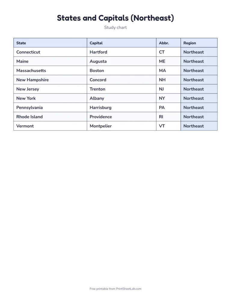
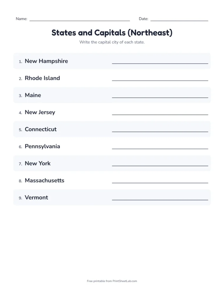
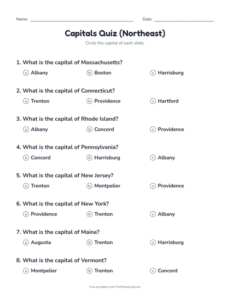
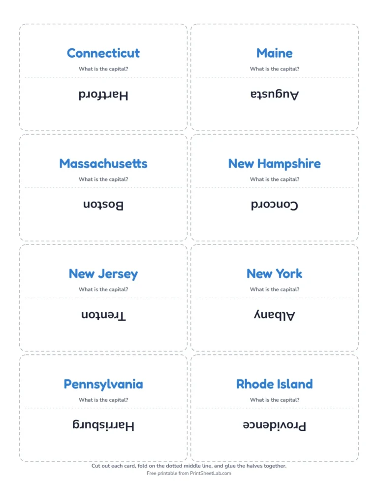
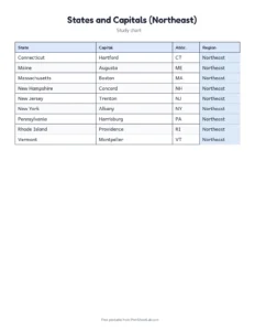
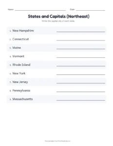
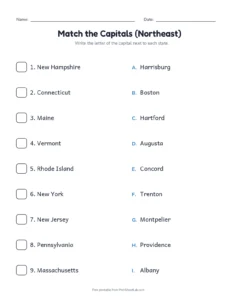
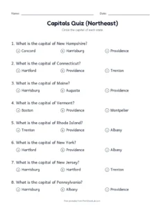
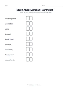
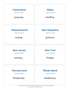
These four pages show the northeast states and capitals worksheets: the study chart, the write-the-capital quiz, the multiple choice quiz and the fold-over flash cards. Click a picture for the PDF, or use the generator above to switch the direction, the number of questions or the paper size.
Study chartAll 9 states in order.PDFWrite the capital quizWith an answer key.PDFMultiple choiceFour answers each.PDFFold-over flash cardsState and capital.PDF
The 9 Northeast states and their capitals
The Census Bureau divides the 50 states into four regions: Northeast, Midwest, South and West. The Northeast region has 9 states. Here they are in alphabetical order, with the capital, the postal abbreviation, the year the state joined the Union and its nickname:
The Census Bureau splits each region into divisions. The Northeast region has 2:
Division
States
New England
Connecticut, Maine, Massachusetts, New Hampshire, Rhode Island, Vermont
Middle Atlantic
New Jersey, New York, Pennsylvania
Learning one division at a time makes the northeast states and capitals worksheet even smaller, with 6 and 3 states in each part.
Northeast capitals list: a fact for each capital
A fact makes a capital easier to remember than a bare name. This northeast capitals list gives one for each state:
Capital
State
A fact to remember
Hartford
Connecticut
Mark Twain lived in Hartford for many years
Augusta
Maine
It stands on the Kennebec River
Boston
Massachusetts
It is the largest city in New England
Concord
New Hampshire
The word concord means agreement
Trenton
New Jersey
It was briefly the national capital in 1784
Albany
New York
It is not New York City, which is the largest city
Harrisburg
Pennsylvania
It stands on the Susquehanna River
Providence
Rhode Island
It was founded by Roger Williams in 1636
Montpelier
Vermont
It is the smallest state capital by population
Northeast states and capitals quiz: what is in the PDF
The generator prints six kinds of worksheet for the Northeast states. This northeast states and capitals quiz table shows how many pages each one has, including the answer key:
Printable
What it is
Pages (with answer key)
Study chart
Every state with its capital, in alphabetical order
1
Write the capital quiz
Write the capital of each state, or the state of each capital; the key is on the last page
2
Matching
Join each state to its capital
2
Multiple choice
Choose the capital from four answers
3
Abbreviations
Write the two-letter postal abbreviation
2
Fold-over flash cards
The state on one side and the capital on the other
2
You can switch the quiz to go from the capital to the state, which is harder. The questions can be listed A to Z, by region or shuffled, and the flash cards and chart can be sorted the same way.
How the Northeast states joined the Union
The order in which the states joined is a good way to organize a study of the northeast region. This table lists the 9 states in the order of statehood:
Order in the Union
State
Year
2
Pennsylvania
1787
3
New Jersey
1787
5
Connecticut
1788
6
Massachusetts
1788
9
New Hampshire
1788
11
New York
1788
13
Rhode Island
1790
14
Vermont
1791
23
Maine
1820
And this table groups the same states by the period when they joined:
When the state joined
Number of states
Which states
Before 1800
8
Pennsylvania, New Jersey, Connecticut, Massachusetts, New Hampshire, New York, Rhode Island, Vermont
1800 to 1849
1
Maine
1850 to 1899
0
none
1900 and later
0
none
Northeast states worksheet: spelling and pronunciation
The longest state name in the Northeast is Massachusetts with 13 letters, and the shortest is Maine with 5. The longest capital name is Harrisburg (10 letters), and the shortest is Boston (6). No capital starts with the same letter as its state. These are the names that cause the most mistakes:
Word
How to say or spell it
Connecticut
kuh-NET-ih-kut, with a silent c
Pennsylvania
penn-sill-VAIN-yuh
Massachusetts
mass-uh-CHOO-sits
Montpelier
mont-PEEL-yer
Northeast capitals named for people
Many capitals are named for people, and a story helps you remember them:
Capital
Named for
Albany
the Duke of Albany, later King James II
Trenton
William Trent, an early landowner
Harrisburg
John Harris, who ran a ferry there
Augusta
Augusta Dearborn, the daughter of a local leader
Facts about the Northeast region and its states and capitals
Delaware is first in order of statehood, but the first of the Northeast states to join was Pennsylvania, on December 12, 1787.
Rhode Island is the smallest state in the country by area.
Maine is the only state with a one-syllable name.
New Hampshire was the ninth state to ratify the Constitution, which put it into effect.
Northeast states and capitals: is the capital the biggest city?
The most common mistake in a states and capitals quiz is to write the largest city, because it is the one that people know. In the Northeast region, only 2 of the 9 capitals are also the largest city in their state. Capitals were often chosen for their position, in the middle of the state or between rival towns, and not for their size. This table shows the capital and the largest city of each state, by population:
State
Capital
Largest city
Same city?
Connecticut
Hartford
Bridgeport
No
Maine
Augusta
Portland
No
Massachusetts
Boston
Boston
Yes
New Hampshire
Concord
Manchester
No
New Jersey
Trenton
Newark
No
New York
Albany
New York City
No
Pennsylvania
Harrisburg
Philadelphia
No
Rhode Island
Providence
Providence
Yes
Vermont
Montpelier
Burlington
No
Cover the capital column and ask the child to name it, then reveal the answer. This works for any states and capitals quiz. The states where the two cities differ are the ones to practice most.
Northeast capitals on the map: rivers and harbors
Most Northeast capitals grew up beside water, because rivers were the roads of early America. This is a quick way to picture the Northeast capitals list and the Northeast states and capitals on a map:
Capital
Where it stands
Albany
on the Hudson River
Augusta
on the Kennebec River
Boston
on Boston Harbor and the Charles River
Concord
on the Merrimack River
Harrisburg
on the Susquehanna River
Hartford
on the Connecticut River
Montpelier
on the Winooski River
Providence
at the head of Narragansett Bay
Trenton
on the Delaware River
Draw the Northeast on a blank map, mark the rivers and place each capital beside its river. The geography makes the names stick.
Northeast states and the original thirteen
Seven of the thirteen original states are in the Northeast. They are Pennsylvania, New Jersey, Connecticut, Massachusetts, New Hampshire, New York and Rhode Island, and the other six are in the South. Maine and Vermont came later. Here are the thirteen in the order that they ratified the Constitution:
Order
State
Region
Year
1
Delaware
South
1787
2
Pennsylvania
Northeast
1787
3
New Jersey
Northeast
1787
4
Georgia
South
1788
5
Connecticut
Northeast
1788
6
Massachusetts
Northeast
1788
7
Maryland
South
1788
8
South Carolina
South
1788
9
New Hampshire
Northeast
1788
10
Virginia
South
1788
11
New York
Northeast
1788
12
North Carolina
South
1789
13
Rhode Island
Northeast
1790
Northeast states by size and population
The Northeast has some of the smallest states and some of the most crowded. Rhode Island is the smallest state in the country, while New York is the largest in the Northeast, with about 35 times as much area. These are rounded numbers, and the last column divides the population by the area to show how crowded each state is:
State
Area in square miles (about)
Population in 2020 (about)
People per square mile (about)
New York
54,555
20,201,249
370
Pennsylvania
46,054
13,002,700
282
Maine
35,380
1,362,359
39
Massachusetts
10,554
7,029,917
666
Vermont
9,616
643,077
67
New Hampshire
9,349
1,377,529
147
New Jersey
8,723
9,288,994
1,065
Connecticut
5,543
3,605,944
651
Rhode Island
1,545
1,097,379
710
New Jersey has the most people for its size, with more than 1,000 people for every square mile, while Maine has fewer than 40. That is why a Northeast states and capitals quiz covers states that are very different, even though they are close together. The Northeast states and capitals are the smallest to learn, with only nine of each.
Northeast states and capitals: five quiz tips
Start with the map. Find each of the northeast states on a map first, and then add the capitals. A child who can place Connecticut knows where to look for Hartford.
Say the pair as one phrase. “Vermont, Montpelier” is easier to remember than two separate words.
Use the fold-over cards. Look at the state, say the capital, then check the other side. This is the quickest way to learn the northeast states and capitals.
Quiz in both directions. Ask for the capital of Vermont, then ask which state has Hartford as its capital.
Spell the capitals aloud. Capitals with two words, such as Hartford, are often written with only the first word.
The nine Northeast states and capitals, one by one
The Northeast states and capitals are small enough to learn in a week, and each one has a story. A single paragraph for each state gives you a story to attach to the name and the capital, which is the best way to remember the Northeast states and capitals:
Connecticut and Hartford
Connecticut joined the Union as the fifth state, on January 9, 1788, and is called the Constitution State. Its capital, Hartford, stands on the Connecticut River, and the name Connecticut comes from a Native American word that means “long tidal river”. A reminder for the quiz: Hartford sounds like a hart (a deer) crossing a ford, which is a shallow place in a river.
Maine and Augusta
Maine joined in 1820 as the twenty-third state, when it separated from Massachusetts, and its nickname is the Pine Tree State. Its capital is Augusta, on the Kennebec River. Maine is the only state with a one-syllable name, and it borders only one other state, New Hampshire. For the quiz, link Augusta with August, a warm month that many visitors spend on the Maine coast.
Massachusetts and Boston
Massachusetts was the sixth state, joining on February 6, 1788, and is called the Bay State. Its capital, Boston, is also the largest city in New England. The state’s name comes from the Massachusett people, and means “at the great hill”. It is one of the longest state names, with 13 letters, so practice the double s and double t.
New Hampshire and Concord
New Hampshire is the Granite State and joined as the ninth state, on June 21, 1788. It was the ninth state to ratify the Constitution, and nine was the number needed to put the Constitution into effect. The capital, Concord, is a word that means agreement, so you can remember that the people of New Hampshire agreed.
New Jersey and Trenton
New Jersey, the Garden State, was the third state, joining on December 18, 1787. The capital, Trenton, was briefly the capital of the United States in 1784 and is named for William Trent, an early landowner. Do not confuse Trenton with Newark, which is New Jersey’s largest city but not the capital.
New York and Albany
New York is the Empire State and joined as the eleventh state, on July 26, 1788. The capital is Albany, not New York City. The most common mistake in a states and capitals quiz is to write New York City, so say “Albany” aloud with the state name a few times. The state is named for the Duke of York, later King James II.
Pennsylvania and Harrisburg
Pennsylvania, the Keystone State, was the second state to join, on December 12, 1787. Its name means “Penn’s woods”, after the founder William Penn and the Latin word for woods. The capital is Harrisburg, on the Susquehanna River, and not Philadelphia, which was the capital of the United States from 1790 to 1800.
Rhode Island and Providence
Rhode Island is the Ocean State and the smallest state in the country by area. It was the thirteenth state to join, on May 29, 1790, the last of the original thirteen colonies to ratify the Constitution. The capital, Providence, was founded by Roger Williams in 1636. Until 2020 the full official name was “State of Rhode Island and Providence Plantations”.
Vermont and Montpelier
Vermont, the Green Mountain State, was the fourteenth state, in 1791, and the first to join after the original thirteen. The capital is Montpelier, the smallest state capital by population. The name Vermont comes from the French words vert and mont, which mean green mountain.
A week of practice with the northeast states and capitals
This plan for the northeast states and capitals uses one printable a day and takes about ten minutes. It finishes with a quiz that children can score themselves:
Day
Printable
Goal
Monday
Study chart, read aloud
Say each state and capital twice
Tuesday
Fold-over flash cards
Quiz a partner
Wednesday
Matching and abbreviations
Match without the chart
Thursday
Multiple choice
Spot the capital among the choices
Friday
Write the capital quiz
Score yourself with the key
Children in grades 3 to 5 usually learn the states and capitals, and learning one region at a time keeps each northeast states and capitals quiz short.
Printing tip
Print at 100% or “Actual size” and turn off “Fit to page”, so every measurement on the sheet is exact. Choose Letter or A4 paper in the generator before you download the PDF.
Northeast states and capitals: frequently asked questions
Why learn states by region?
Nine to sixteen states at a time is far easier than fifty, and regions match how many classes teach U.S. geography.
Which regions are used?
The four U.S. Census Bureau regions: Northeast, Midwest, South and West.
How many states are in the Northeast region?
There are 9 states in the Northeast region.
Can I quiz from the capital to the state?
Yes. Choose “Capital to state” in the generator for a harder northeast states and capitals quiz.
Are the northeast states and capitals worksheets free?
Yes. They are free to print for home and classroom use, with no sign-up.